ISRO’s BIG WARNING! Satellite images show entire Joshimath town at risk of sinking
Joshimath sinking: The land subsidence was slow between April and November 2022, during which Joshimath had sunk by 8.9 cm. But between December 27, 2022, and January 8, 2023, the intensity of land subsidence increased and the town sank by 5.4 cm in these 12 days.
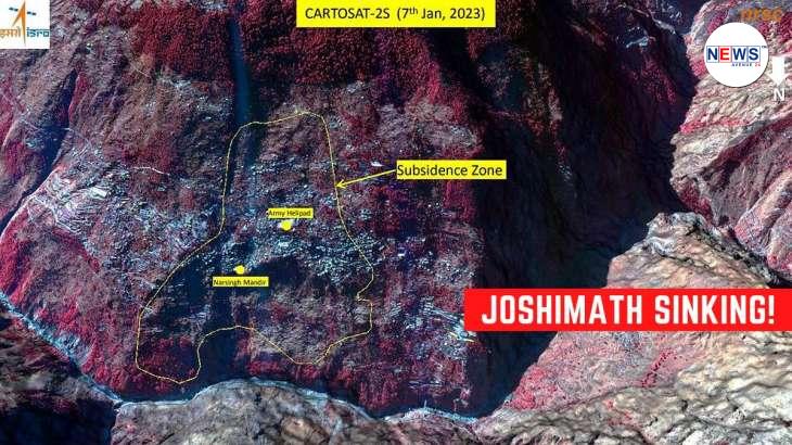
Joshimath sinking: The National Remote Sensing Centre (NRSC) of the Indian Space Research Organisation (ISRO) has released satellite images of Joshimath. Meanwhile, a preliminary report on land subsidence shows that the entire town may sink in the coming time.
According to the report, the land subsidence was slow between April and November 2022, during which Joshimath had sunk by 8.9 cm. But between December 27, 2022 and January 8, 2023, the intensity of land subsidence increased and the town sank by 5.4 cm in these 12 days.

Earthquake in Uttarkashi
Meanwhile, an earthquake of magnitude 2.9 hit Uttarkashi in the early hours of Friday, according to National Centre for Seismology. The earthquake struck at 2.12 am which has kept officials at Joshimath on alert.
What satellite images show?
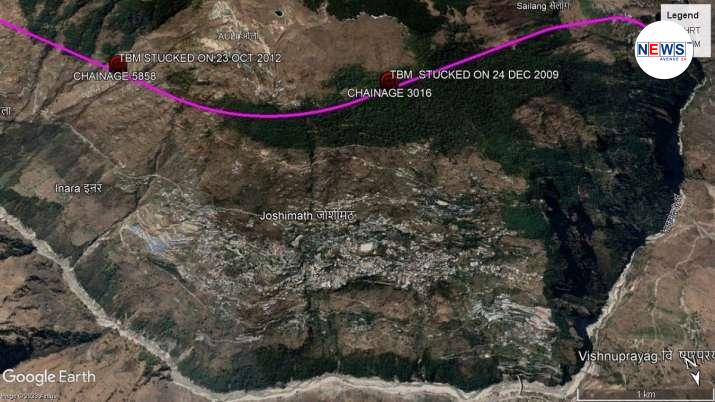
The satellite images also revealed that the Joshimath-Auli road is also going to collapse due to land subsidence. The subsidence zone is located at central Joshimath only including the Army Helipad and Narsingh Mandir, the satellite images revealed. The crown of the subsidence is located near Joshimath-Auli road at a height of 2,180m.
It should be mentioned here that Joshimath, the gateway to famous pilgrimage centres, such as Badrinath and Hemkund Sahib, and international skiing destination Auli, is facing a major challenge due to land subsidence. A total of 169 families living in the town have so far been shifted to relief centres.
News Sources – India Tv News


